
Main page
|


LaserMap advanced kernel library for digital map processing/rendering and GPS navigation
Main features
Vector based layer separated mapping data organization model
Original compact mapping data storing format
Soft scale line
Dynamic inscription placing depended on current view position and scale
Original inscription overlapping prohibition algorithm
Original graphic subsystem with lines and fonts antialiasing
Effective map generalization subsystem
Advanced map image quality on large scale range
Map image rotation
Fast rendering subsystem
Best route tracing support
NMEA 0183 v.2.0 compatible GPS devices support
Current position and orientation displaying
Map object searching by name and address
Posix and Win32 compatible code
ArcInfo Shape import converter with built-in geodetic projections and datums coordinate
conversion and advanced flexible SQL based DBMS data processing
Compatibility
Operation systems:
Win32 (Windows 95/98/ME/NT/2000)
Windows CE (ver. 2.11 and later including PocketPC and PocketPC 2002)
Linux
CPU types:
Intel Pentium and compatible (Win32 and Linux)
StrongArm (Windows CE)
MIPS (Windows CE)
SH-3 (Windows CE)
SH-4 (Windows CE)
Color system:
24 bits RGB color
32 bits RGB color under request
16 bits RGB color (5-6-5)
15 bits RGB color (5-5-5) under request
12 bits RGB color (4-4-4) under request
8 bits grayscale
Developer kit complement
Map import converter (optional)
Interactive map show rules customization application
Dynamic or static library files
C++ header files with function set description
Commented samples code
NMEA 0183 v.2.0 driver module (optional)
Online road traffic information processing module and subsystem (optional)
Application capability
Map based software
Customized GIS applications
Navigation software
Software for in-car navigation systems
Interactive tour guides
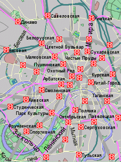
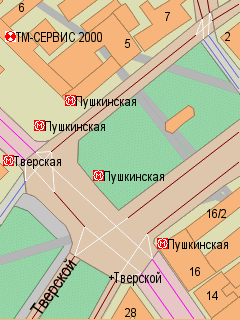
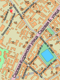
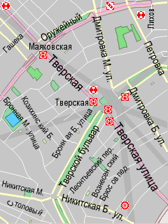
More map image samples
Available on
LaserMap web server page
Designed by V.Osipkov sw
development team (vctos@email.com)
Last updated: 15 Nov 2001
|